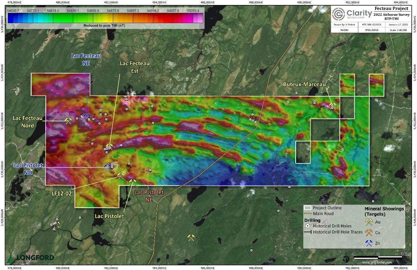
Fecteau Property preliminary results showing RTP-TMI from recently completed airborne Triaxial Magnetometer survey. Image Credit: Clarity Metals Corp.
The data from this survey will be used by Clarity to interpret the lithology and geological structures which are known in the Abitibi to influence gold mineralization.
To improve the understanding of the region and further prioritize current targets in addition to identifying new targets, this data will be combined with findings from other winter exploration efforts, including a diamond drilling program and an extensive remote sensing program.
The property is known to contain mesothermal gold and VMS (Cu-Zn-Au) mineralization.
Many gossans of semi-massive to massive sulfides are present along and close to an east-west trending rhyolite-dacite contact that has been detected over 10 km of strike, and these gossans serve as an excellent representation of VMS targets in the field.
Anomalous copper-zinc intervals associated with anomalous gold were discovered during previous drilling conducted close to the surface. On the property’s western and eastern ends, where the volcanic sequence is folded, mesothermal quartz veins bearing gold are visible. Parallel to the axial plane of the folds, east-west striking shear veins of a meter scale are formed.
Axiom Exploration Group Ltd. carried out this helicopter-borne survey using a specially created GEM Systems GSMP 35A Airborne Potassium Vapor high-resolution magnetometer mounted on a non-magnetic stinger in a triaxial array.
For locating any structural or lithological breaks, the survey, which used 75 m line spacing and 768 line km of the survey, produced a map with a noticeably higher resolution than the 2008 survey.