Jul 16 2012
Effective July 1, 2012, companies and individuals will pay double the value of the corresponding assessment work requirement for Payment Instead of Exploration and Development (PIED). The previous rates were equivalent to the value of exploration and development work. These changes will impact decisions companies and individuals make as there is a risk of forfeiture if assessment work is not completed on time and companies are not able to come up with the additional money to pay the fees. This can be a serious problem since forfeiture makes it possible for other companies and individuals to acquire the mineral tenure.
According to David McLelland, owner of Auracle Geospatial Science Inc., a remote sensing and geospatial company in British Columbia, mining claim owners may not be aware that remote sensing qualifies as exploration work under the Mineral Tenure Act (MTA). “It would be unfortunate for companies to lose mineral claims that are still valuable and of interest because they haven’t completed work and can’t generate the extra fees,” explains McLelland. Remote sensing is a cost-effective way to gather and analyze vast amounts of information from large areas without being on the observed surface. One of its greatest advantages is that it can be conducted in remote areas, in virtually all weather, even when the ground is snow-covered.
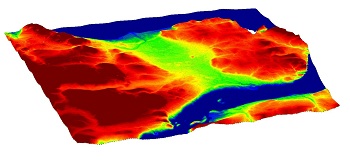 A 3-D model from Auracle Geospatial Science Inc.
Some exploration companies have gotten caught in the red-tape associated with obtaining licenses and permits required to get into or to work in an area. Remote Sensing doesn’t require social license or a permit so there are no additional permitting costs and it is something that can be started immediately. It can be conducted without public scrutiny.
Auracle Geospatial Science has developed specialized protocols to fuse multivariate image multi-temporal spectral satellite data, radar sat panchromatic data and knowledge based geological data to produce a new type of image of the area. These new images more clearly identify fault structures, rock lithologies and alterations that are not visible on simple satellite images, aerial Lidar images or geological maps. Structures and alterations that have the highest probabilities of containing mineralized areas are identified so that exploration can concentrate on more detailed and narrow targets. These methodologies have been used to identify probable scarns, porphories, veins, surficial uranium deposits, SEDEX, VMS and kimberlites.
McLelland reports that what is unusual about AGS work is that they are typically able to identify and map things that are usually considered “blind” like structures that are discontinuous at surface but that may be seen in radar or alteration minerals, such as Buddingtonite, which can be pathfinder indicators for mineral deposits, which cannot be seen by geologists with the unaided eye.
Results can be presented in a technical report with digital and mapped data derivatives, depending on the project needs. Generally, AGS provides Digital Elevation Models, topographic maps, structural (fracture lineament) models, mineral and alternation spectra maps, and thermal anomaly maps, all of which are orthorectified and georeferenced to meet or exceed the jurisdiction’s mapping standards.
In addition to its applications to maintain mining claims throughout British Columbia, Auracle Geospatial Science has successfully applied remote sensing to large scale projects in various global locations and climates, including Greenland, the Northwest Territories, Newfoundland, Yukon, Colombia and Africa.
About Auracle Geospatial Science Inc:
Auracle Geospatial Science Inc (AGS), a remote sensing and geospatial company, offers a comprehensive range of spatial information services that include image processing, spectral and spatial analysis and modeling to the natural resources sector. For more information, visit www.auracle.ca or contact David at 250 738 0459.