Why Hyperspectral Imaging?
Drone- and Ground-Based Scanning
Effectiveness of the Approach
Drone-Based Hyperspectral Remote Sensing
Recent Developments
The Way Forward
References and Further Reading
Hyperspectral imaging is bringing a new level of detail to mineral mapping at mine sites. Using drone- and ground-based scanning, the technology captures information across highwalls, dumps, and leach pads, revealing variations in mineral composition.1-4
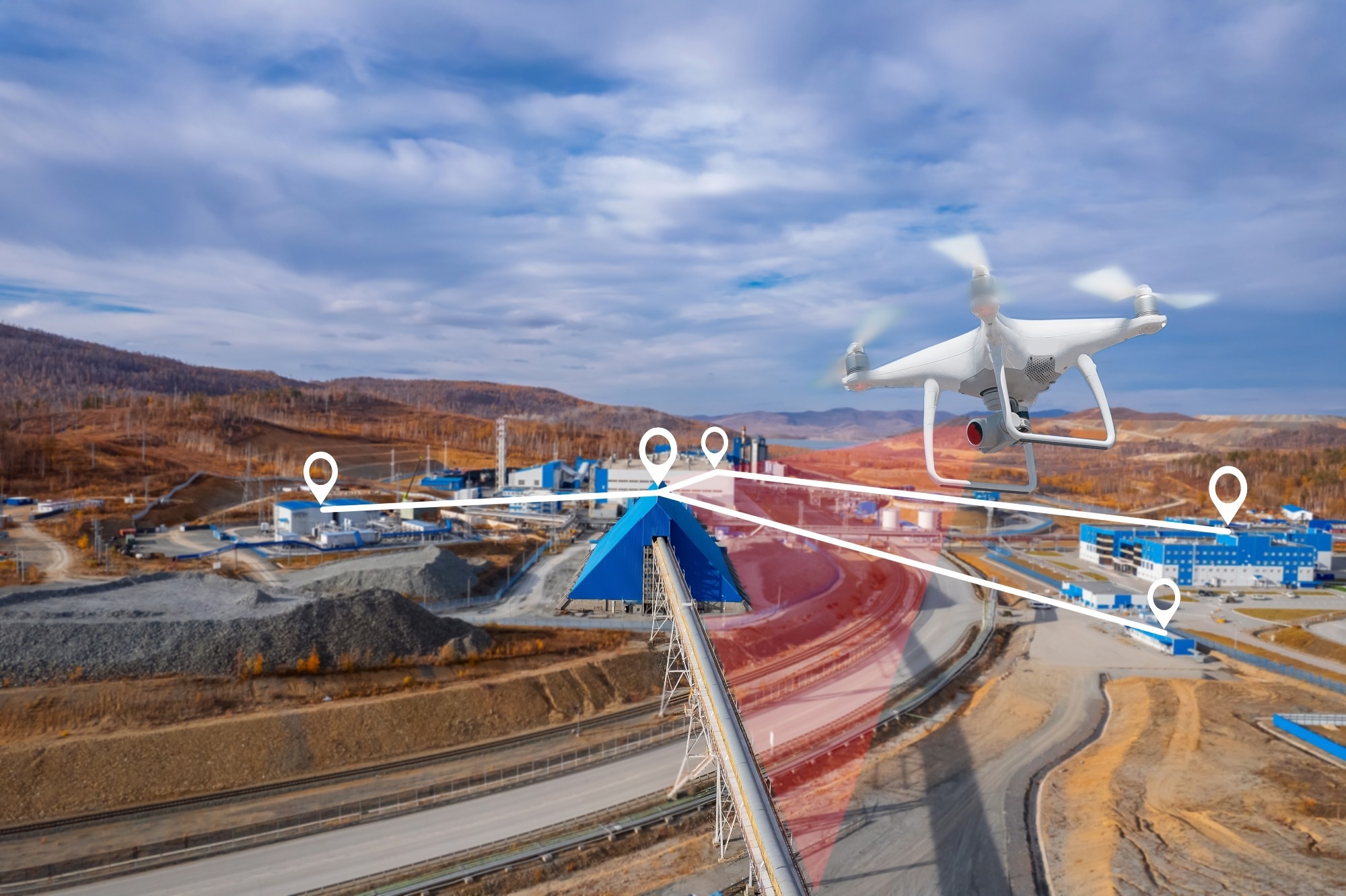
Image Credit: Parilov/Shutterstock.com
Thus, hyperspectral imaging serves as an important tool to extrapolate observations from mapping and delineate the distribution of clays and other hard-to-identify but important mineral species for geometallurgical purposes.1-4
Why Hyperspectral Imaging?
Geometallurgy depends on detailed characterization of the mined rock at several scales. Existing geometallurgical techniques are suitable for assessing blast hole and core samples. However, obtaining detailed mineralogical data at the scale of an ore deposit, leach pad, or mine in the field remains a challenge.1
Thus, in most modern mines, the actual mineralogy of a volume of rock can only be known when it has been excavated and processed. Hyperspectral imaging can complement existing sample- and mapping-based analytical methods in mining.1
This technique, which is a type of spectrometry, is based on the selective absorption of wavelengths of light by scanned materials. Scans create a spectrum with inverted “peaks” corresponding to the vibration of chemical bonds in the material.1
Drone- and Ground-Based Scanning
A paper published in Mining, Metallurgy & Exploration investigated drone- and tripod-based field hyperspectral imaging for mineral mapping at a large scale in and around the active Lisbon Valley copper mine, including previously producing uranium-vanadium mines, natural exposures, dumps, highwalls, and leaching sites.1
The objectives were to determine whether this method can map the mineral distribution around various mine settings reliably, and to determine how this method can be suitably used for production-oriented, safe, and large-scale characterization in mining environments.1
Tests included varying mineral spectral reference libraries, various unsupervised and supervised mineral data classification methods, integration with light detection and ranging (LiDAR) data, and comparison with ground-truth spectroscopic and geological mapping and sampling.1
Hyperspectral scanning was conducted using both tripod- and drone-based systems over four days, with ground-truth or check data and samples being collected throughout the summer. Digital elevation maps (DEMs) were downloaded from the United States Geological Survey (USGS) and provided by the mine.1
These were supplemented where necessary by flying a LiDAR sensor on the drone and creating a DEM from the resultant point cloud. Two Headwall Photonics Micro-Hyperspec systems were used to perform the scans. Steep or vertical faces were scanned by aligning and mounting these systems on a rotating tripod.1
However, the systems were utilized separately on a DJI Matrice 600 Pro drone for scanning flat areas. For the drone flights, the average height above ground was 60 meters, leading to an approximately six-centimeter-per-pixel ground sample distance.1
Effectiveness of the Approach
Hyperspectral scans generated spatially registered maps of the distribution of various spectrally active mineral types over highwalls, dumps, natural outcrops, and leach pads. Clays, other phyllosilicates, sulfates, and carbonates were detected and mapped effectively.1
Additionally, the sensors distinguished dry from lixiviant-saturated areas and mapped diverse clay types on the leach pads. It also differentiated health and types of vegetation.1
These findings indicated that hyperspectral imaging, coupled with effective ground-truthing, could suitably complement existing geometallurgical methods in the mining sector, including handheld spectrometry, blast hole sampling, automated mineralogical identifications, and geological mapping.1
Specifically, hyperspectral imaging has the potential to map the distribution of sliming, heap-blinding, swelling clays, and acid-consuming minerals, and identify problem areas on heap leach pad surfaces.1
Drone-Based Hyperspectral Remote Sensing
In hydrometallurgy operations, mapping the distribution of surficial features, like ponded lixiviant, pipes, and minerals, remains a persistent challenge. A paper published in Hydrometallurgy evaluated
drone-based hyperspectral remote sensing for leach pad mapping using the Safford mine as the test site.2
Results showed that hyperspectral remote sensing could obtain information about the piping system, mineral distribution, and lixiviant ponding. Gypsum, muscovite, and kaolinite were the major minerals identified on the leach pads. However, gypsum detection was attributed to the extensive sulfate precipitation from agglomerating acid and lixiviant.2
While biotite and chlorite were not detected in the results, they were present on the leach pads. In mapping leach pads, the best practices for hyperspectral remote sensing are using low spatial resolution for mapping minerals and high spatial resolution for mapping piping systems; scanning before leaching starts; scanning leach pads in sunshine; and building a reference library from ground-truth samples.2
Recent Developments
Researchers at the University of Queensland have helped develop a new hyperspectral imaging system that allows near real-time aerial mapping for environmental monitoring and mineral exploration. The development has happened through the European-led M4Mining consortium.3,4
Specifically, the Sustainable Minerals Institute (SMI) of the University of Queensland has contributed remote sensing, industry, and geoscience expertise to the M4Mining consortium. The institute validated the technology through case studies in regional Queensland before its eventual testing in Brisbane.3
M4Mining is a European Union (EU)-funded initiative to improve material characterization during remining, extraction, environmental impact monitoring, and exploration. The objectives are to realize mineral classification using UAVs in real time, enabling seamless three-dimensional (3D) visualization.4
Advanced software and hardware are being developed by the consortium for monitoring and mapping inactive and active mining sites using satellite sensors and unmanned aerial vehicles (UAVs).4
In the drone-mounted system, advanced remote sensing is integrated with sophisticated data processing to create comprehensive 3D models of survey sites while detecting patterns in vegetation and minerals simultaneously.3
The processing of complex aerial data immediately after a survey using a drone-mounted hyperspectral imaging platform eliminates the need to wait for weeks or months for usable datasets. Exploration teams can access such datasets when a drone lands, enabling faster decision-making.3
Norsk Elektro Optikk AS, a Norwegian imaging company, has integrated the technology into a commercial product under its HySpex brand after successful validation in Europe and Australia. This enables wider adoption of the technology across the global mining sector.3
The Way Forward
Hyperspectral imaging is emerging as a valuable tool for advancing mineral characterization and geometallurgical decision-making across mining operations. Its ability to rapidly map mineral distributions, leach pad conditions, and environmental features can complement conventional sampling and analytical methods.
With continued advances in drone-mounted systems, real-time data processing, LiDAR integration, and commercial platforms, hyperspectral technology could enable faster, safer, and more comprehensive mine-site characterization, supporting improved resource management and operational efficiency.
References and Further Reading
- Barton, I. F., et al. (2021). Extending geometallurgy to the mine scale with hyperspectral imaging: A pilot study using drone-and ground-based scanning. Mining, Metallurgy & Exploration, 38(2), 799-818. DOI: 10.1007/s42461-021-00404-z. https://link.springer.com/article/10.1007/s42461-021-00404-z.
- He, J., DuPlessis, L., & Barton, I. (2022). Heap leach pad mapping with drone-based hyperspectral remote sensing at the Safford Copper Mine, Arizona. Hydrometallurgy, 211, 105872. DOI: 10.1016/j.hydromet.2022.105872. https://www.sciencedirect.com/science/article/abs/pii/S0304386X22000573.
- Thomas, J. (2026). UQ advances Horizon-funded hyperspectral imaging tech for faster mineral exploration. [Online] Innovation News Network. Available at: https://www.innovationnewsnetwork.com/uq-advances-horizon-funded-hyperspectral-imaging-tech/71137 (Accessed on 27 August 2026).
- Advancing Mining with hyperspectral UAV & Satellite Monitoring. [Online] M4MINING. Available at: https://www.m4mining.eu/ (Accessed on 27 August 2026).
Disclaimer: The views expressed here are those of the author expressed in their private capacity and do not necessarily represent the views of AZoM.com Limited T/A AZoNetwork the owner and operator of this website. This disclaimer forms part of the Terms and conditions of use of this website.