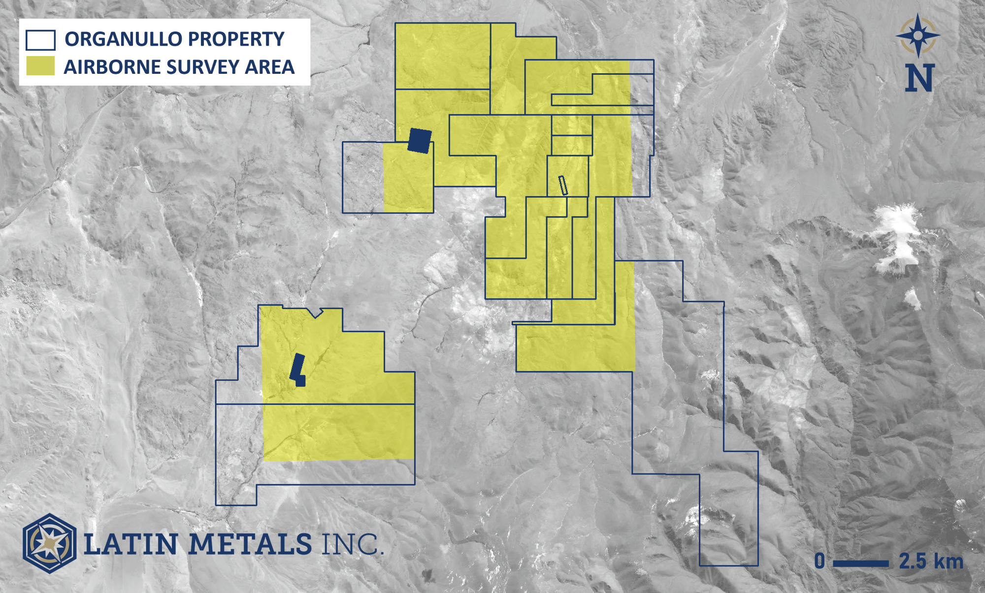
Map showing the Organullo property claims under option to AngloGold and the area where airborne geophysical survey has been completed. Image Credit: Latin Metals Inc.
Keith Henderson, Chief Executive Officer, Latin Metals
Airborne Survey Details
Airborne geophysical surveys use sensors and devices mounted on an aircraft to acquire subsurface data. Prior to drilling, the primary purpose is to gain a better understanding of the distribution of subsurface rock types and mineralization.
Due to the utilization of aircraft to collect data, the method is more expensive than ground-based methods, but it is more efficient and virtually fully non-invasive, limiting the impact on flora, fauna, and local residents.
AngloGold's survey covered the majority of the Property in eleven days and acquired magnetic and radiometric data along 3,500 line-km. Survey lines were flown at an average flying height of 60 m above ground on a 100-meter north-south and 1,000-m east-west spacing.