Mining activities involve the mass removal of rock, which can have destabilizing effects on the surrounding geology. The result includes landslides, rock bursts, and other dangerous events that can cause injury or death, as well as cause damage to property and the surrounding environment.
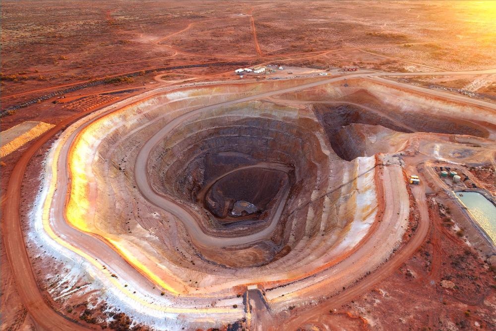
Image Credit: Symbiosis Australia/Shutterstock.com
Fortunately, accidents are relatively infrequent at mining sites due to robust risk prevention systems. Many modern operations use radar-based mining operations monitoring to either detect emerging hazards or respond quickly to a hazardous situation.
Using Radar in Mining Operations Monitoring
At open cast mining operations, slope stability mining radar (SSMR) can provide real-time geohazard monitoring and advanced warnings of a dangerous slope collapse. This type of radar system can predict an imminent collapse based on telltale submillimeter movements of material on the face of a slope.
State-of-the-art systems combine radar technology with visual imaging technology as they continuously scan areas for signs of impending collapse. These systems typically have several alarm features that save lives, prevent property damage, and avoid environmental disasters.
Geohazard radar is a different type of system that is used to detect and track already-moving hazards after a collapse. When a landslide or avalanche occurs, this system alerts mine workers and others nearby using sirens, lights, and digital alerts.
Real-Time Geohazard Monitoring Solutions
The new RGR-Velox radar from industry-leader GroundProbe is the latest in real-time geohazard monitoring technology. According to the company, the new system combines military-grade doppler radar hardware and the company’s proprietary software to track moving hazards in real-time and alert nearby personnel.
The RGR-Velox system uses a continuous sweeping motion to record real-time data, effectively imaging a scene every 0.25 seconds. The mining operations monitoring system detects incremental motion with a high degree of accuracy. It can sense the movement of material happening at a rate of only 0.05 meters per second.
This is the first reactive monitoring system from Groundprobe. The company recently celebrated its 20th anniversary of operations, growing from a small start-up to a global brand. It claims to have never had an unexpected collapse in a mining operation where one of its systems was in use.
Introducing RGR-Velox
Video Credit: GroundProbe/YouTube.com
Radar in Safety Monitoring of Underground Operations
Underground mining operations can be hazardous. Using ground-penetrating radar and other tools, tunneling operations avoid unstable regions of rock and hazards such as karst voids.
These subsurface cavities are created by the dissolution of soluble rock. Responsible for causing sinkholes on the surface, karst voids are a major geohazard in the mining industry and can cause deadly collapses and rock bursts.
Mining operators looking to detect voids and other hazards typically use ground-penetrating radar to send radio signals into the rock strata. Signals that are reflected to the radar unit reveal the nature of the medium through which they have traveled. Conductive media, such as wet clay or soils, attenuate radar signals, while dry media are ideal for the transmission of radio waves. The propagation of electromagnetic waves enables the detection of minerals and masses of solid rock.
In the past, the information provided by analog radar systems provided limited data that had to be interpreted by experienced operators. Today, ground-penetrating radar systems are often complemented by digital imaging technology to produce highly detailed, three-dimensional models of the rock medium.
Many current mining operations use this technology in underground tunnels to detect conditions beyond the working face. They use this information to plot a path for tunnel boring machines. Operators can direct a boring machine around rock that has been loosened by blasting operations, or fissure water that may be dissolving rock.
Radar can also be used for highly specific mining applications. For example, a study from the National Institute for Occupational Safety and Health (NIOSH) revealed that ground-penetrating radar could be used to detect the effective spread of grout sand into the roof of a tunnel, which is a common hazard remediation technique. This radar can also be used to characterize the extent of fractures and assess the integrity of supporting rock pillars.
The effectiveness of ground-penetrating radar in mining operations is still a major topic of study and safety-focused research.
References and Further Reading
GroundProbe. RGR-Velox. [Online] Available at: https://www.groundprobe.com/product/rgr-velox/
Kumar, A. The Role of Mining Radar in Open Cast Mines. Global challenges, Policy Framework & Sustainable Development for Mining of Mineral and Fossil Energy Resources. https://www.sciencedirect.com/science/article/pii/S1878522015000612
Gleeson, D. (2021) GroundProbe reflects on geohazard monitoring developments on 20th anniversary. IM Mining. [Online] Available at: https://im-mining.com/2021/10/22/groundprobe-reflects-geohazard-monitoring-developments-20th-anniversary/
Disclaimer: The views expressed here are those of the author expressed in their private capacity and do not necessarily represent the views of AZoM.com Limited T/A AZoNetwork the owner and operator of this website. This disclaimer forms part of the Terms and conditions of use of this website.