California Lake Drillhole (CL23-10-01) Trajectory Analysis. Image Credit: Nine Mile Metals Ltd.
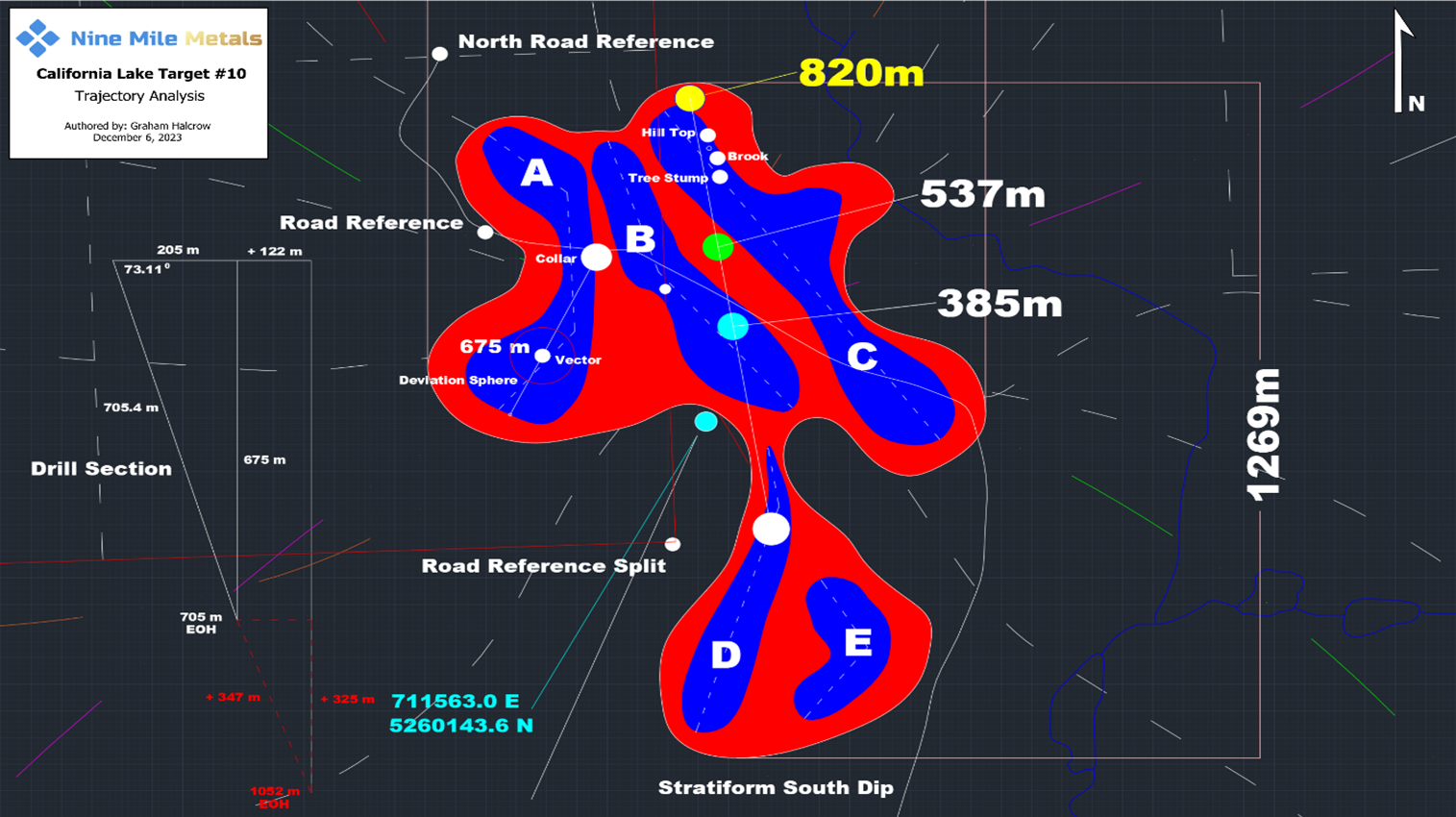
Azimuth and dip monitoring must be done continuously because of the desired drill hole’s length. Following the collaring of the drill hole, a gyro survey is carried out every 30 meters to record the azimuth and dip. To make sure the drill hole is inside the specified parameters, the trajectory is then computed and shown.
An accurate map of the trajectory can be obtained by conducting a continuous gyro survey, which records information at 1-meter intervals. If a significant divergence is found, the drilling can be adjusted to reroute the hole to the intended location.
After examining the drill core, geologists from the New Brunswick Department of Mines and Energy were able to establish the existence of rhyolites, sediments, and phengite alteration, among other components of the Flat Landing Brook Formation. The drill core revealed nothing unexpected, and every type of rock that was found is typical of this area of the BMC.
The team is very pleased with progress to date. The Chapais drill team has been very diligent maintaining the trajectory of the hole while also providing excellent core recovery. Geologically, we are encouraged by the results to date, the host rocks relating very well to the classical model below (Figure 3), especially the intense alteration intersected which is associated with the Flat Landing Brook rhyolites.
Gary Lohman, B.Sc., PGO, Director and Vice President, Exploration, Nine Mile Metals Ltd.
Kevin B. Hicks, Director stated, “Drilling remains on track and the projected landing location at target depth remains well within our target radius. The drilling rate in meters per day will slow as we progress deeper in the hole due to core retrieval cycling and the hardness of the rock. Given the shallowing of the dip angle, our measured depth target has gone from 705 to 720 meters for a true vertical depth target of 675 meters. We look forward to next week and our continued drilling of this important hole on the tip of the California West VMS Trend.”
Numerous rock types have been encountered while drilling thus far, including highly unique red sediment that is known to exist close to VMS mineralization at the Stratchens Lake Brook occurrence to the west and the Ahearn Brook occurrence to the immediate north.
Extended sequences of felsic volcanics, a crucial element of the VMS hypothesis, could be found beneath the red sediments. They have encountered extensive rhyolite sequences at California Lake, some of which show strong phengite alteration. The host rock could bleach along with an abrupt alteration halo.
The drill core has also revealed sequences of banded pyritic strata up to five meters wide, indicating a depositional environment. Base metal mineralization includes tiny blebs of chalcopyrite (copper) inside sections of Fe enriched (black) chlorite; the latter, when of significant size and enrichment, constitute Zone 2 above. Zinc is linked with larger blebs of pyrite, as proven by XRF.
The geological sequences found in drill hole CL-23-10-01, albeit still above target depth, are typical of a VMS environment. High temperature mineralogy and locally strong hydrothermal alteration of the volcanic are further promising signs of a possibly prolific VMS system at depth.